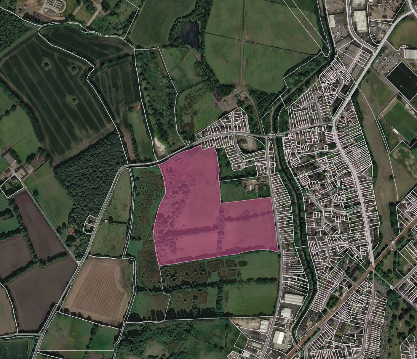
Site area
22.71 acres
Land reviewed within the proposal boundary.
Option proposal · private & confidential
A focused proposal to unlock the residential potential of your land through the development of care and affordable housing scheme, leveraging the planning weight attached to both uses.
Foster, Green + Brown Limited
“Hard work, honesty and the strength of the team are what turn difficult sites into successful projects.”Andy Rhoades · Owner
Over 25 years working within the residential development sector, I have been part of teams securing planning for a wide range of projects across the Midlands.
From hostels to extra care, low-rise residential to supported housing, and sites ranging from 0.5 acres to 20 acres, none of these projects were easy. They succeeded through hard work, honesty and strong professional teams.
We apply that experience—together with our motivation to create new homes—to maximise the likelihood of securing planning consent. We specialise in affordable housing and believe it can often unlock challenging sites.
We hope this proposal is of interest and that you will trust us to work diligently on your behalf to maximise the value of your land.
The land
The site provides 22 acres of grazing land adjacent to Walsall Wood, with frontages onto Green Lane and Hall Lane. The land can be divided into 3 distinct parcels, the land fronting Hall Lane which feels most connected to the urban area and provides immediate opportunity to progress an exception/ grey belt site on the basis of a care and affordable housing use. The land fronting Green Lane sits immediately to the west of a small scale emerging allocation, and immediately south of a very large emerging Cameron Homes allocation. The third parcel is the land closest to the SSSI designation, which on the ground feels very rural and likely fails the grey belt test.
Site area
22.71 acres
Land reviewed within the proposal boundary.
Local authority
Walsall
Walsall Metropolitan Borough Council
Planning history
None
No previous planning applications identified.
The team
We invest in experienced specialists to maximise the likelihood of securing planning approval quickly and managing risk from the outset.

Planning + design
Multi-disciplinary planning, design and development advice focused on securing permissions and optimising land value.

Infrastructure + environment
Infrastructure, landscape and environmental expertise supporting a coordinated, sustainable development solution.

Legal
Commercial legal advice with particular strength in social housing, real estate and development agreements.

Technical
Pragmatic technical support focused on risk management, approvals and accelerating residential delivery.
Current projects
Our current portfolio demonstrates practical experience across affordable housing, allocations, grey belt and planning appeals.
Under option
9 sites
Active landowner partnerships.
Approximate capacity
480 homes
Across the current portfolio.
2026 submissions
7 sites
Applications targeted at proposal date.
Coven
Emerging allocation in the South Staffordshire Local Plan.
Allocation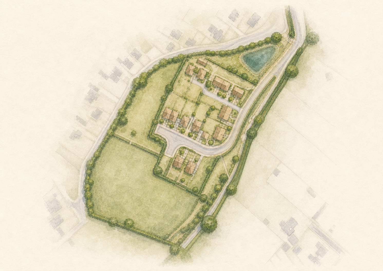
Sedgeberrow
Outline permission secured at appeal for 16 homes.
Rural exception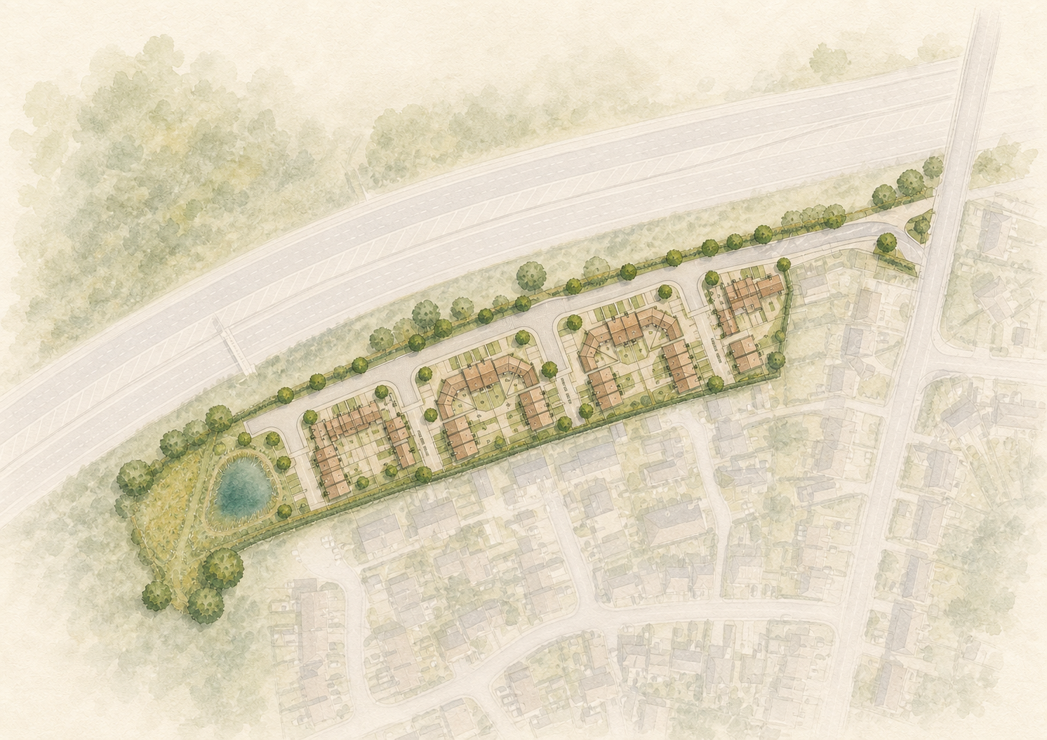
Catshill
Grey Belt application being progressed for 50 homes.
Grey Belt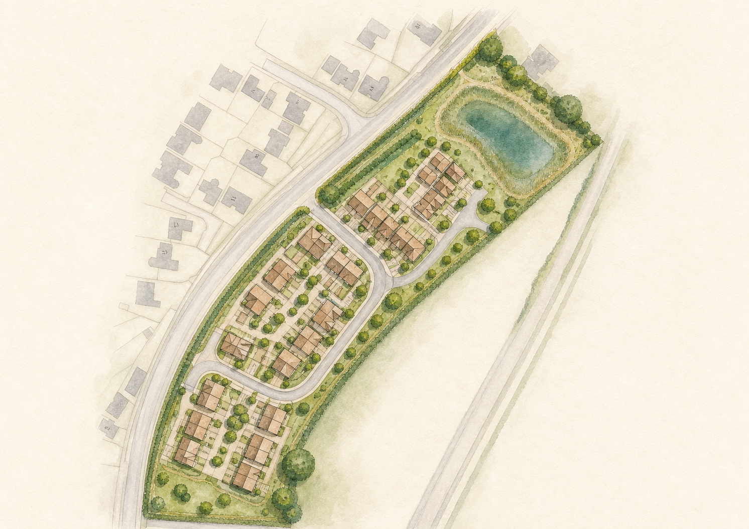
Hartlebury
Grey Belt application being progressed for 41 homes.
Grey BeltOur review of your land
We have reviewed the land and focused on the issues most likely to affect the planning strategy, cost and deliverability.
From a technical perspective, the land is generally flat, and there is little evidence of any current or historic uses that would raise concern. There are established hedges on the site which should likely be retained if possible, along with some trees. Helpfully, the trees are generally located around the site's perimeter and therefore don't affect the net developable area significantly. There is evidence within the site of two ditches which may be useful from a drainage outfall perspective. Online mapping shows that the western element of the site is affected significantly by surface water, along with small areas within the eastern fields fronting Hall Lane. There is an SSSI immediately west of the wider site. A Public Right of Way is located immediately south of the site but helpfully sits outside of the land in question. There are no specific heritage constraints in close proximity to the site.
Planning constraint
The site is within the Green Belt and is not included in the emerging Walsall Local Plan. A shorter-term application would therefore need to rely on a grey belt, exception, or combined route.
Planning strategyTechnical constraint
Online mapping shows significant surface-water effects across the western part of the site, together with smaller affected areas in the eastern fields fronting Hall Lane.
Online mapping reviewEnvironmental constraint
An SSSI lies immediately west of the wider site. Its proximity is a serious constraint to development of the western land and informs the proposed open-space and BNG strategy.
Site context reviewTopography
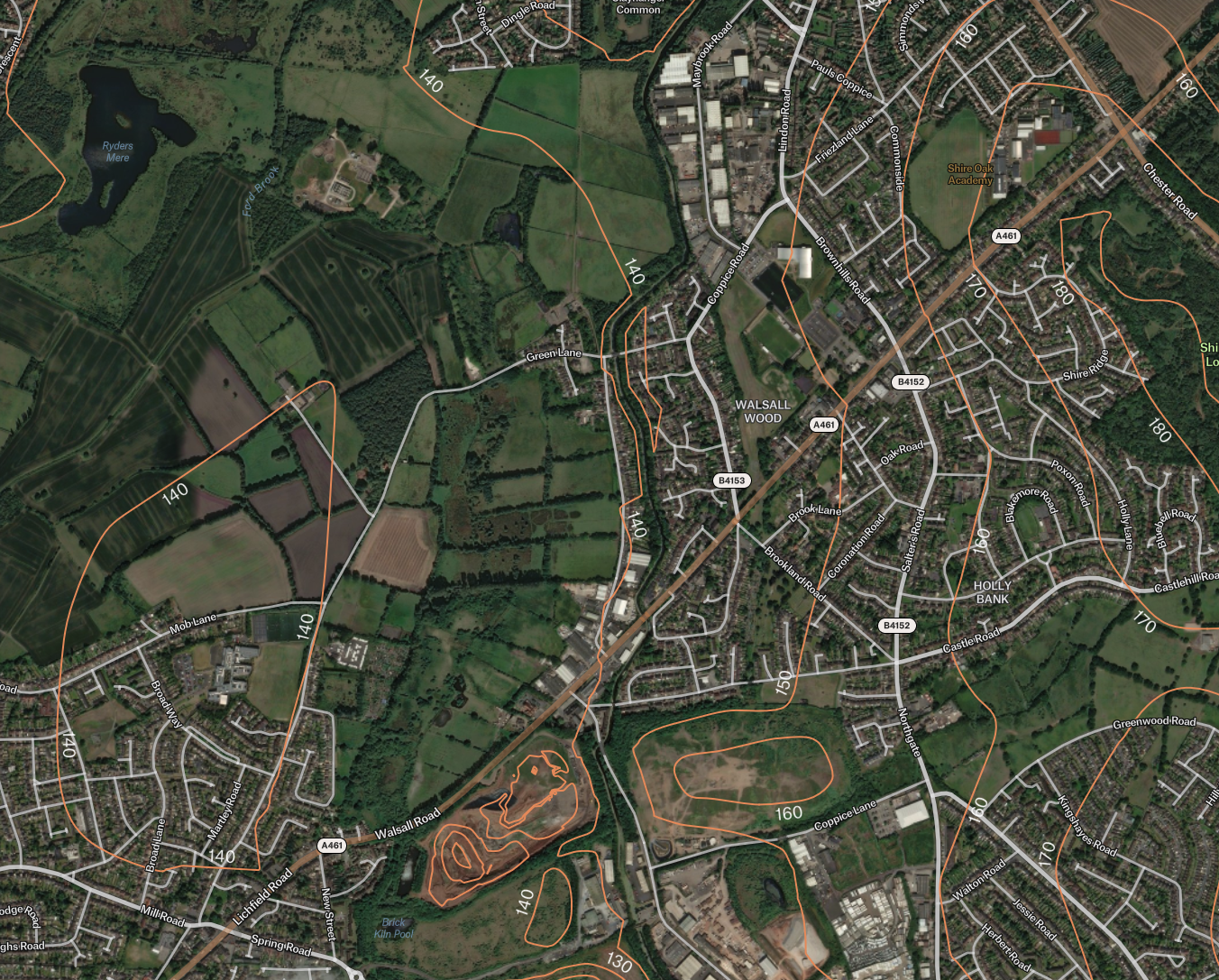
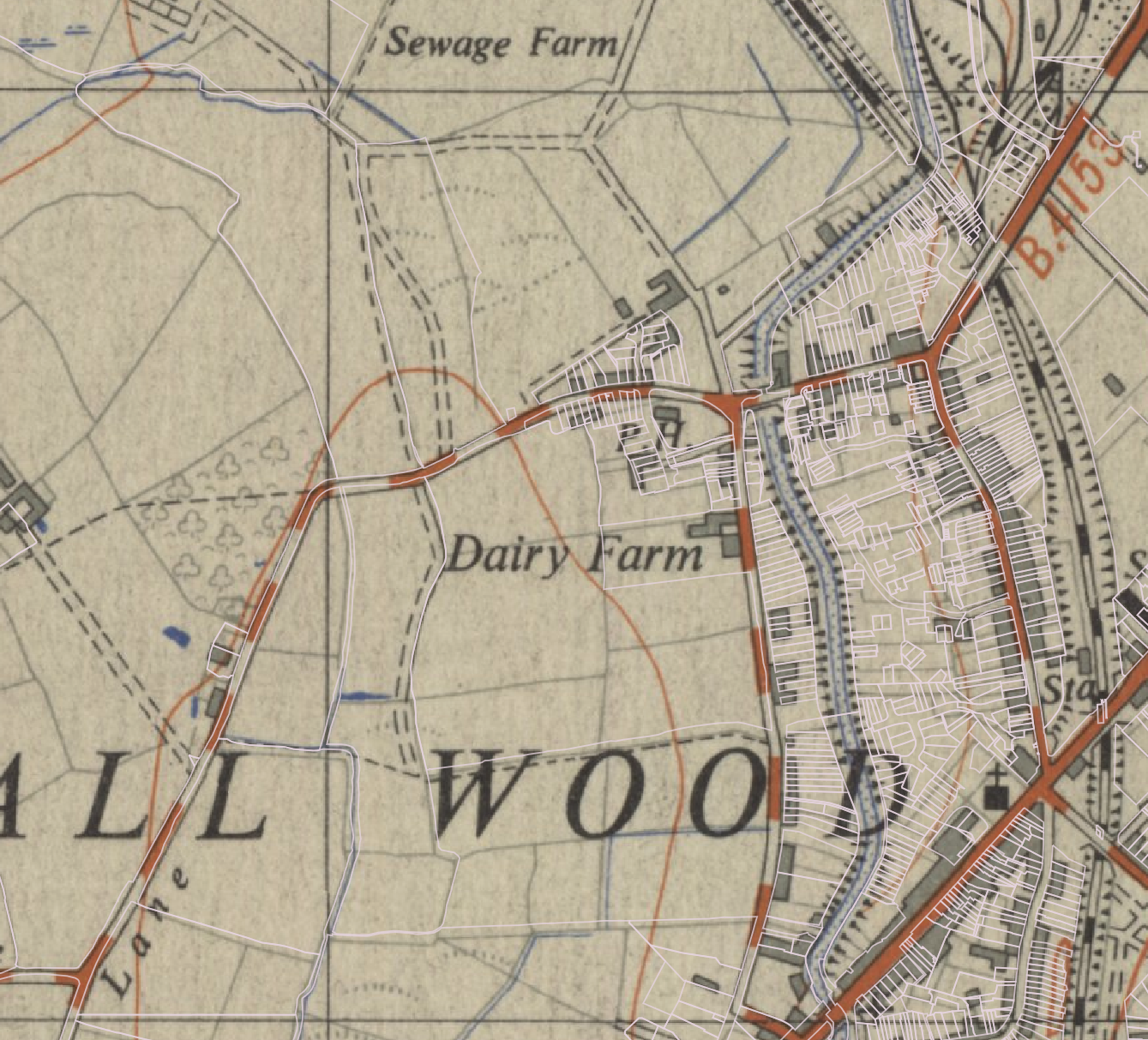
The site falls from 136 DTM to 132 DTM from east to west although it is relatively flat from north to south. This is unhelpful as it will make discharging foul waste more challenging and likely necessitates a pumping station. However, the overall gradient is generally fairly shallow and therefore it is expected that there will be limited retaining features within any development.
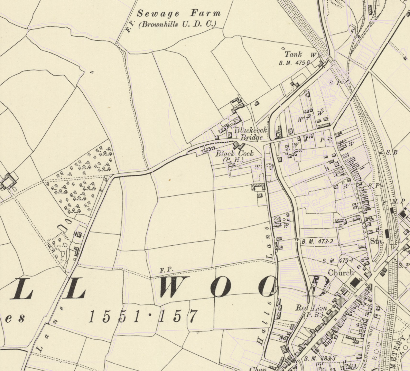
Historic mapping
The available historic mapping does not indicate contentious former uses likely to create abnormal development cost or materially affect the planning case.
Planning strategy
“Strategy is about choices and trade-offs.”
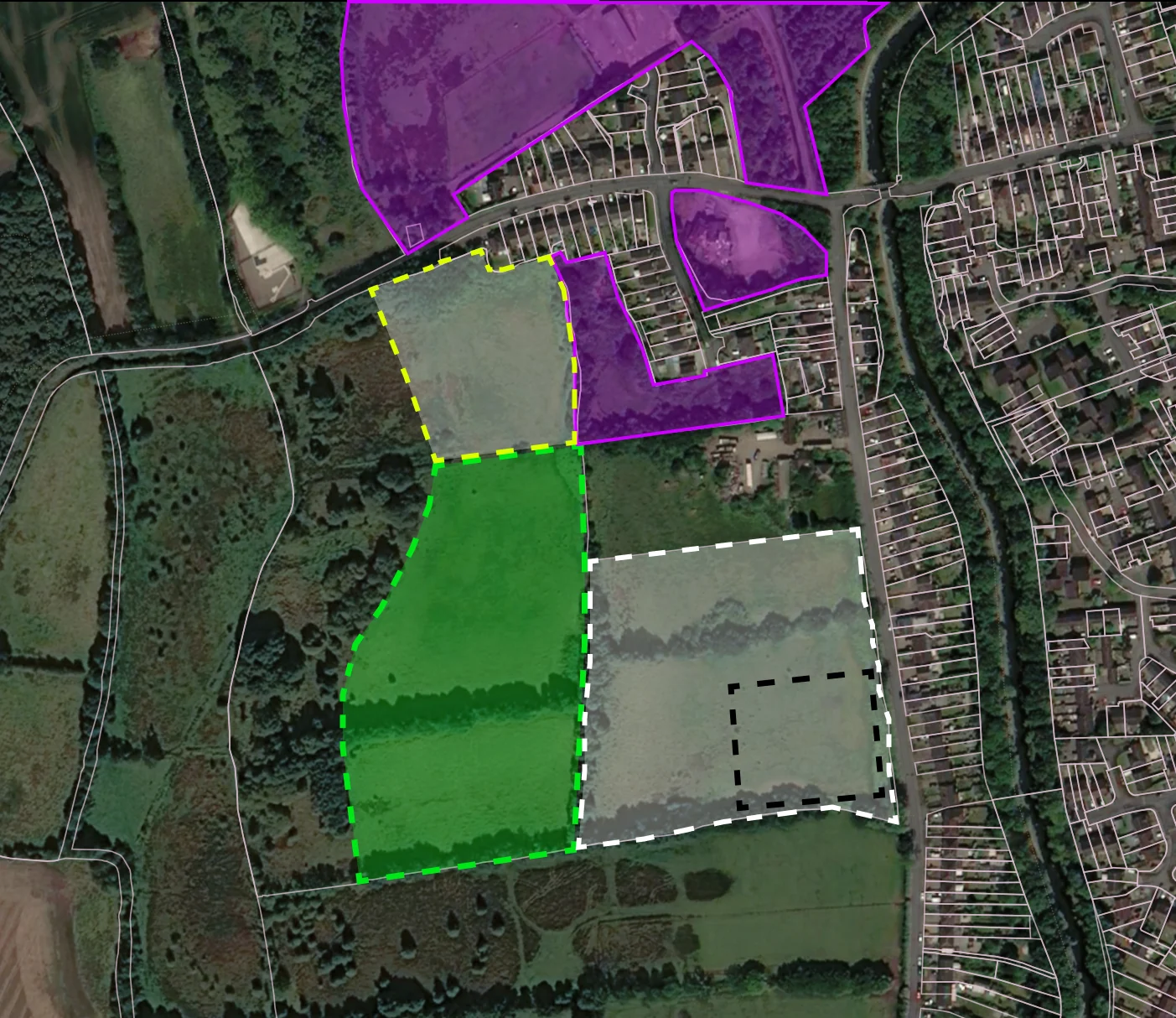
The site is large and has some complexities. The first thing to consider is that the emerging Walsall Local Plan does not include this site, and this, alongside the green belt designation, means that bringing the site forward in the shorter term will require an application on either a grey belt or exception (or grey belt and exception) basis. We propose an approach that breaks the site into 3 sections. The first section is the land to the north which sits immediate west and south of emerging allocations. On the ground it is difficult to consider how this parcel could be considered grey belt, but spatially it is clear that Walsall have identified the general area for development. We therefore believe that the right approach to this smaller parcel would be longer term promotion of the land into the next Local Plan for an open market development. This maximises the chances of securing development on the site, and more importantly a longer term approach to this parcel means that it could be delivered for a more traditional open market use, rather than affordable, which would likely generate a higher value for the parcel than an affordable use. We believe that including this parcel within an immediate application would diminish the chances of securing consent on the wider site.
The second and third elements of the site are where the more immediate opportunity sits. We believe that the fields fronting onto Hall Lane would stand a good chance of meeting the grey belt 'golden rules'. These fields feel more urban and connected to Walsall Wood. These fields naturally split on an east/west basis at the hedgerow running north to south through the site. Our proposal would be to locate the care home and affordable housing on the fields east of the hedgerow, which would align with the extent of the emerging Oakwood Close allocation. These front fields would total just under 7 acres in total and could provide the care home and between 60-80 affordable homes. A partner care home operator has been engaged and has confirmed interest in delivering a 66 bed care home to the south part of the east fields, and Dwello are onboard to work with a well respected partner RP to deliver the affordable housing. The land west of the hedgerow, which feels very rural once you are standing there, and is adjacent to the SSSI would be utilised to provide the required open space. Our intention would be to work with local stakeholders to develop plans for this land that opened it up to the public for a 'nature space' with informal paths, seating areas etc. We would look to deliver any required Biodiversity Net Gain within this space, through the creation of wildflower meadows, long grasses etc.
Proposed tenure
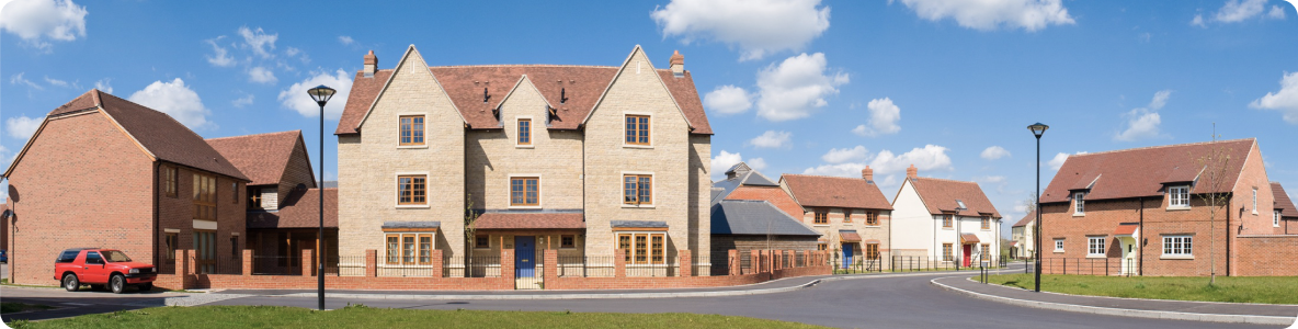
100% affordable + 66 bed care home.
A strategy designed to attract significant planning weight.
Delivery partner
Identified
Housing Association engagement supports the application.
Core argument
Housing Need
A locally evidenced need capable of outweighing Green Belt harm.
Local precedent
The strategy is designed to evidence a locally relevant need for affordable housing and care, creating a stronger planning proposition for Walsall Wood.
Development proposals
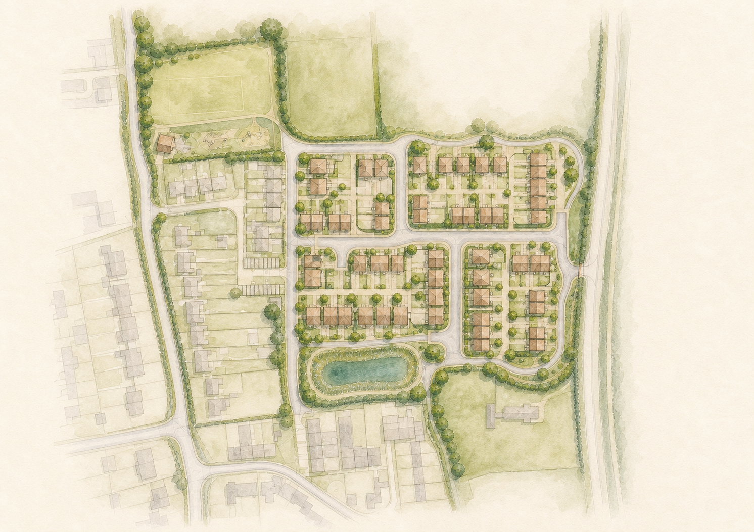
The illustrative layout shows the 3 distinct areas within the site. We see the land edged white as the key area to locate built form on. The black edge area to the south of this land is the preferred location for the care home, but in general we see the whole of this white edged area being developable. The land to the north, and edged yellow, is the land we believe should be promoted long term for an open market use. When we visualise this land next to the emerging allocations (coloured purple) you can see how, from a spatial perspective, this parcel feels ideal for promotion but as things stand it is unlikely to find support on a grey belt basis. The land edged green is the space we feel will be difficult to develop in both the short and medium term, with its proximity to the SSSI considered a serious constraint. This land should be used to deliver any BNG and open space requirements from the other sites, allowing these other sites to be fully developed. It should also be an area we can use to offer benefits to the public.
How we will progress
The work is structured into four practical stages, with the evidence and design developed before the application is submitted.
Confirm the opportunity, objectives and initial delivery case.
Stage 1Commission surveys, test key risks and engage the delivery partner.
Stage 2Prepare the layout, technical reports and affordable-housing case.
Stage 3Submit, validate and manage the application through determination.
Stage 4Timescales
Our consultant team is ready. The programme is designed to move from agreement to application quickly while retaining sufficient time for an appeal if required.
Legal agreement
≈ 8 weeks
Our typical target after agreeing terms.
Planning submission
Within 6 months
Commitment from entering the agreement.
Target determination
≈ 15 months
Overall expectation, subject to the authority.
Terms · our offer to you
We will fund and manage the work needed to pursue planning permission quickly and effectively.
The proposal reflects the significant cost of the planning submission and the relatively complexity of the site. The commercial structure is linked directly to the amount of the site that secured planning permission.
Minimum purchase price
£1,200,000
For white and green land.
Per net developable acre
£250,000
Based on a minimum of 6.5 acres first phase (exception application) and 2.5 acres for the second phase (promotion)
70-plot assumption plus care home
£1,500,000
If the current target capacity is achieved for white and green land. Further agreement and payment for yellow land.
Proposed option
24-month agreement, conditional solely upon planning approval, with extension provisions if the application remains undetermined.
Cost commitment
FG+B would meet the planning costs and cover reasonable legal or agent costs incurred by the landowner. A minimal option fee is proposed.
Proposal terms subject to agreement, legal drafting, planning evidence and final heads of terms.
Next steps
If you would like to progress with Foster, Green + Brown, the next actions are intentionally straightforward.